
SWCP: Worth Matravers Loop
I am walking the South West Coast Path in manageable sections with my mum and the dog. This write up is from a visit to Dorset in October 2020. You can find out more here.
After walking from Lulworth Cove to Kimmeridge Bay and experiencing many, many steep hills, we decided to take a bit of a break from that stretch. I scoped out the OS map properly and judged from the contours that there was a loop from Worth Matravers village, out around St Alban’s Head on the South West Coast Path and then back to the village that was fairly flat. Ish. As flat as you get on this part of the Coast Path anyway.
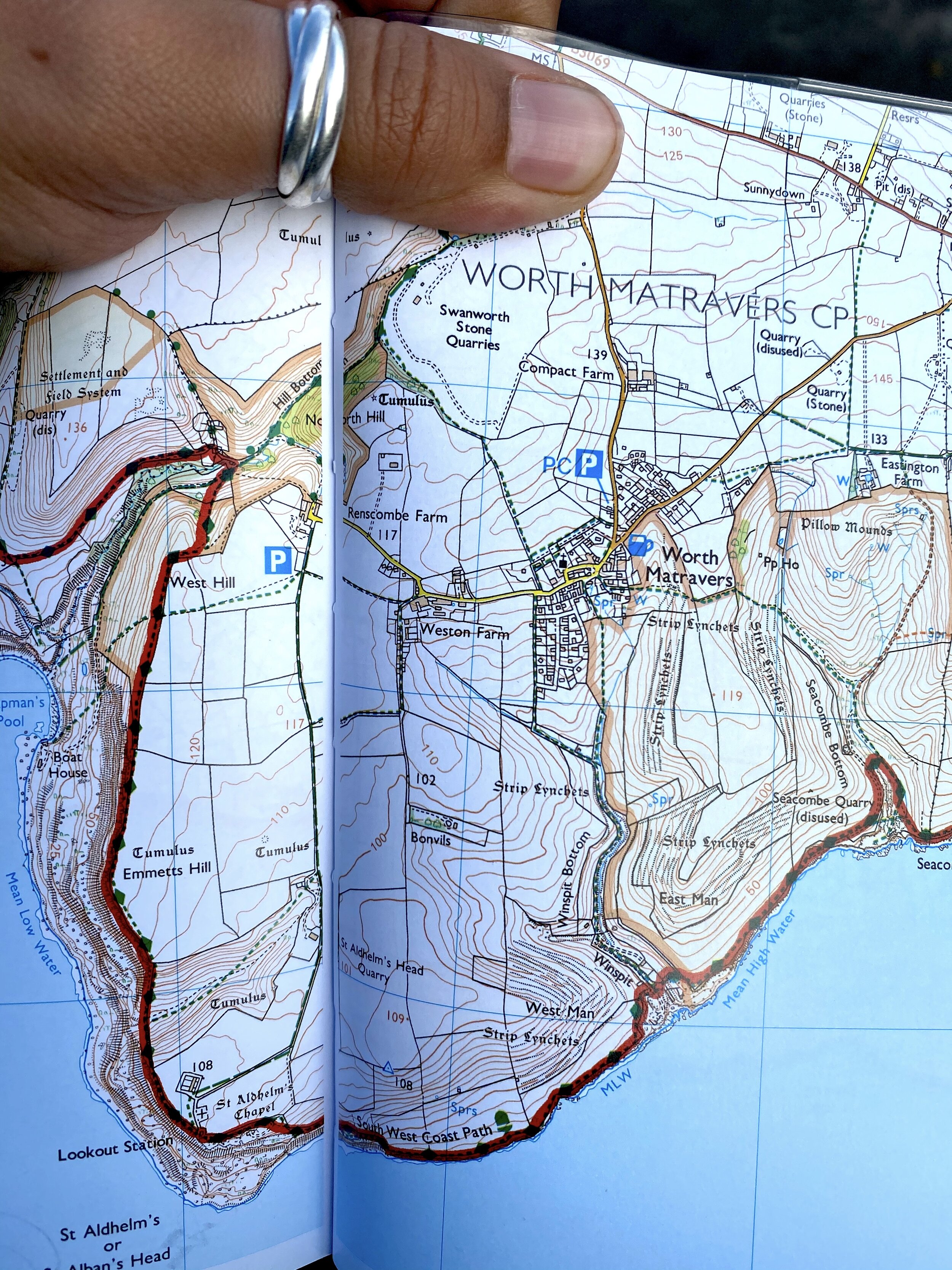
St Albans Head in the South West Coast Path Map Booklet - Plymouth to Poole (affiliate link)
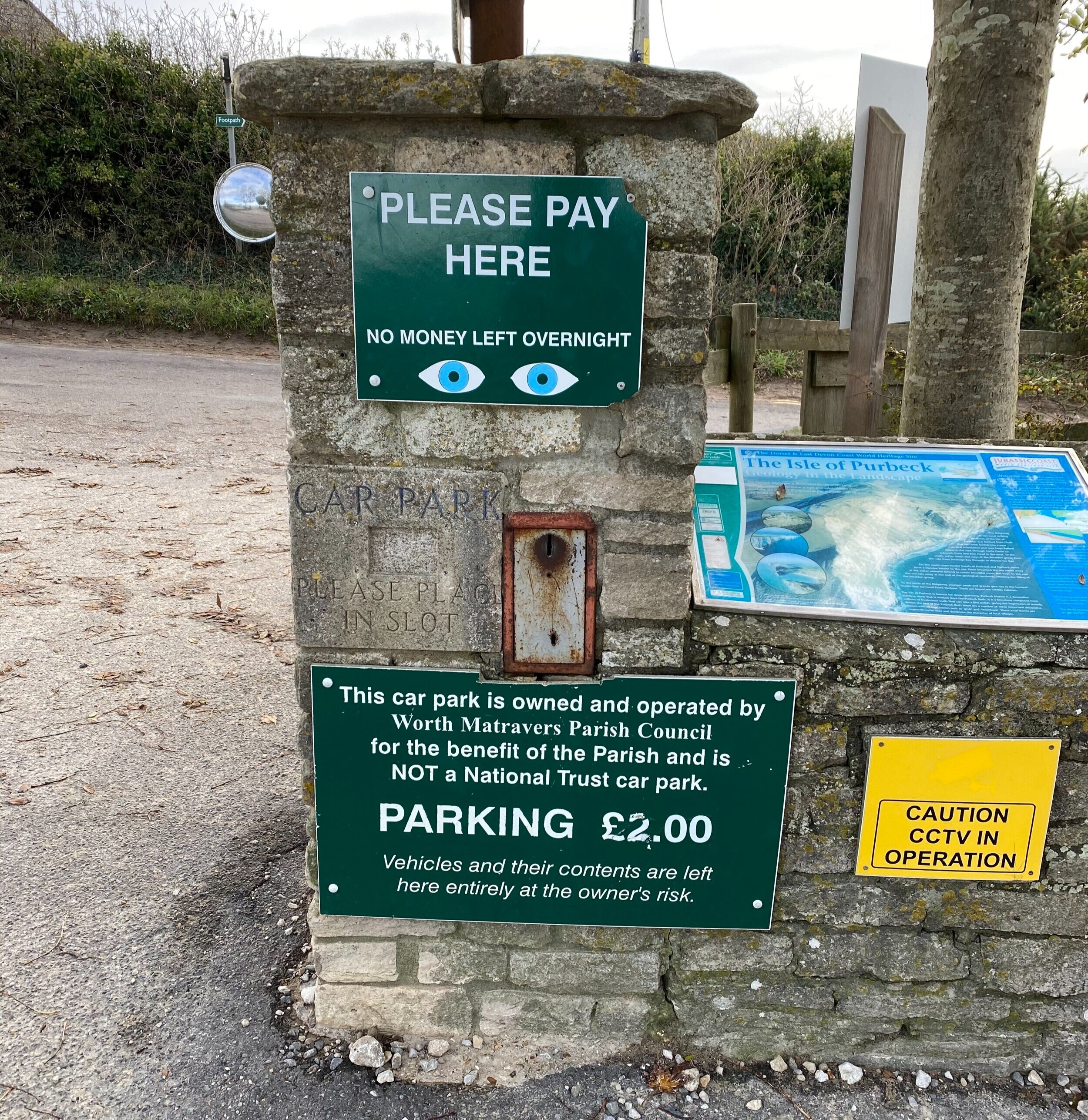
We parked in the Parish Council car park and paid the princely sum of £2 into their community payment slot, then headed out along the ‘main’ road through the village, to join a footpath and then the coast path by Chapman’s Pool. It’s worth noting there is a small car park at the beginning of the footpath out towards Chapman’s Pool, but we decided we’d rather get the slightly longer road walk out the way at the beginning rather than the end. It’s all psychologically strategic you see.
Joining the Coast Path on Emmett's Hill
When we hit the Coast Path, we turned left along Emmett’s Hill and walked along the headland. This first part is blissfully flat and to your right you have views along the coastline to Kimmeridge Bay (and beyond!). There is not any fencing between you and the cliff edge here, but we were walking on a nice day so we didn’t feel too exposed. We were pretty cocky, as we could see right the way across the headland so we were thinking, this is going to be a very flat stroll on a rather lovely day. (I don’t know how we keep scoring these beautiful sunny days but I’m not complaining!

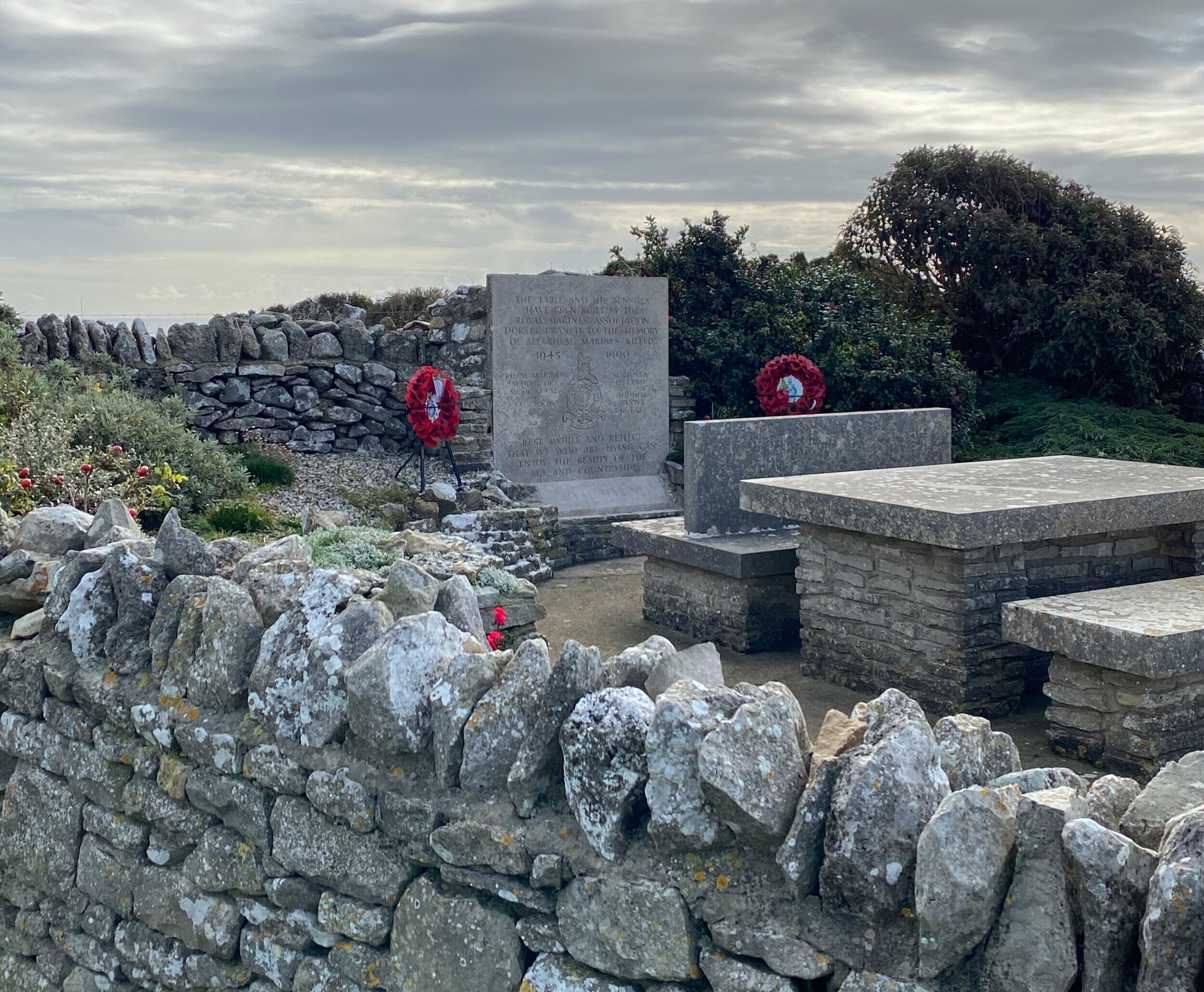
We passed a memorial to fallen Royal Marines on the path, featuring a stone table and benches – a very beautiful spot to place it and a reminder engraved “Rest awhile and reflect that we who are living can enjoy the beauty of the sea and countryside”.
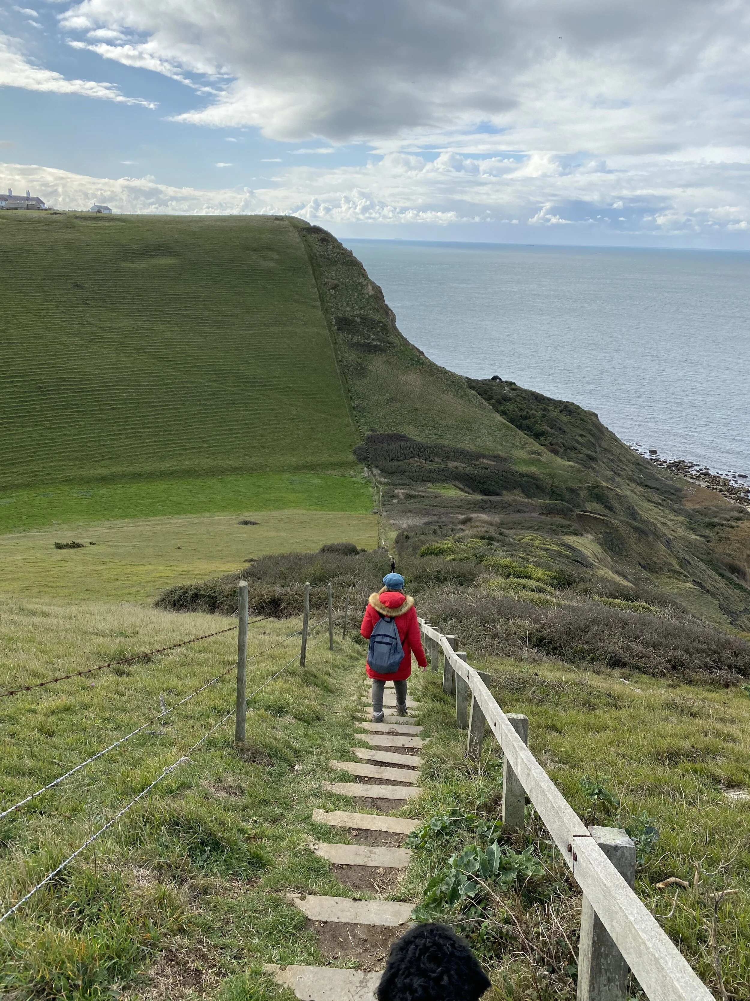
As we turned a bend, we soon discovered that it was definitely not completely flat as we had first thought (hoped?). There is long steep section into a valley and then back up again immediately with steps on both sides. You can see a line of coastguard cottages at the top of the steps on the far side. It looked unpleasant but actually compared to the climbs and drops we had experienced previously, it wasn’t really all that bad. We climbed out the top and sat on a surprisingly high stone bench – I could swing my legs! – for a few minutes to admire the view.
Me and my mum have a running joke at the moment about a ‘welcome bench’ since we came across a hand drawn map in a guidebook which marked them on it. It’s even funnier because when I read it, I thought it meant a specific ceremonial welcome bench, not that it was just welcome because you could sit on it (ha). This was a welcome bench.
St Alban's Point
We had arrived at the point of St Alban’s Head – as well as the Coastguard Cottages, there was a small stone box chapel (currently closed due to COVID), a memorial to the development of radar in World War II and a National Coastwatch Institution Station, which is manned by volunteers. On our way through this had a cheerful crew on a maintenance mission – replacing, painting and fixing. Having a quick chat to one of the guys, he explained how much work needs to go into maintaining it because it takes a battering from the elements. It was looking very smart to me!

On the side of the NCI Station, there are references to St Aldhelm’s, as well as St Alban’s. When I looked into it, it turns out that the chapel is St Aldhelm’s and they think that somewhere in history someone accidentally transcribed it or mistakenly copied it as St Alban’s instead. So the headland is now called St Alban’s, but actually it probably should all be St Aldhelm’s. Got it?
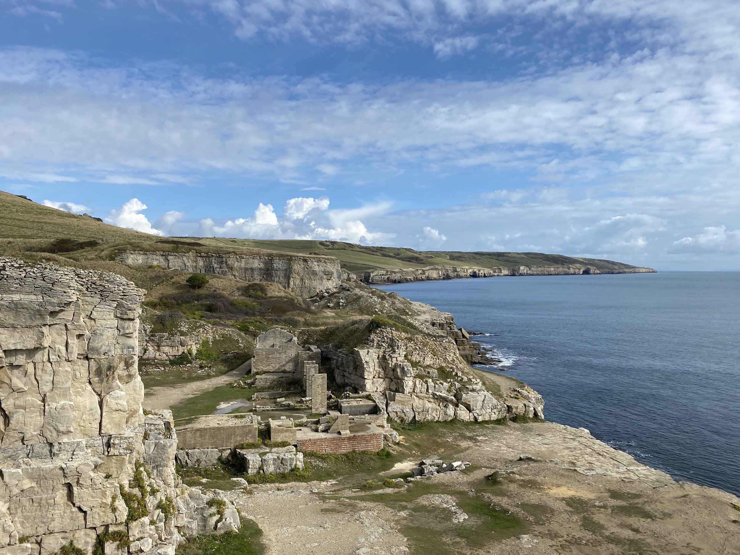
Walking to Winspit
As we started on the path along the headland from the radar memorial, we were passed by two men coming the other way. “Are you going to Winspit? It’s pretty muddy”
It turns out that they didn’t mean, ‘You’re about to wade through knee deep mud’. What they meant was ‘You are about to walk along a very thin path on the top of quite high cliffs with no fencing and there is a very light layer of intermittent mud on top of slightly slippery clay’. The walking conditions on the day we were doing this walk were pretty perfect – no wind, no rain, sunshine. This is not a walk I’d like to do in wet and windy weather because of the proximity to the cliff edge and the potential for a slippery path.
In fact, I had my freak out moment as we approached Winspit, which is a disused quarry. There are steps that wind down to the quarry, which were a little muddy from people walking up and down. For Coast Path steps, they are pretty wide but for some of this (quite high) section, there is no fencing on the side with the drop and on the other side there is barbed wire.
The dog got a bit enthusiastic when he heard other people and dogs, and so he was pulling slightly on the way down. As I tried to counteract this, I slipped on the stone steps and had to grab the barbed wire fence to stop myself from falling over. I managed to rebalance myself but it really put me on edge (literally) and I was a very shaky, as I recognised that I was actually very lucky to only have some surface cuts on my hand from the barbed wire. The Coast Path is not health and safety friendly, that’s for sure. It’s up to you to judge the risk factors, be sensible and make the best decisions you can with the information you have.
Winspit is a pretty quarry showcasing light Purbeck stone. You can turn left here to head straight back to Worth Matravers village. As we are ticking off the sections of the South West Coast Path, we continued on the Path for a little longer before turning back towards the village on a footpath across a field of cows. Every half a mile counts!
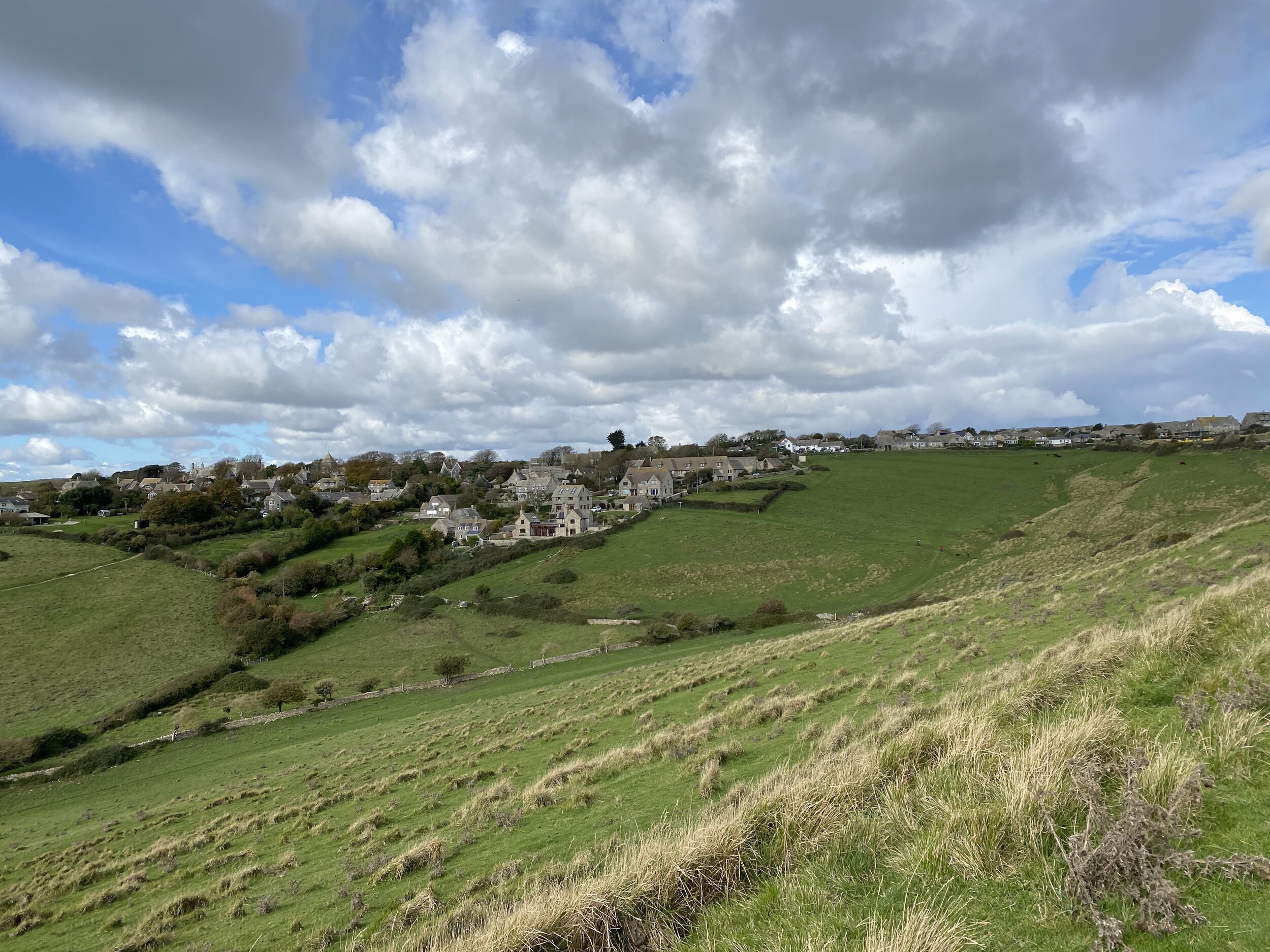
The footpath re-entered the village and led through to the centre where there is a traditional red phone box, duck pond and tea room (currently offering COVID-friendly takeaways but usually offers eat in options). From there it was a short uphill walk back to the Parish Council Car Park. Another section completed in beautiful weather!
Walk statistics

Walk overview from the Viewranger App

If you liked this post, you can subscribe to my newsletter to receive my writing on travel, nature, sustainability and outdoor activities straight into your inbox. If you have found my content useful and want to support my writing, you can buy me a coffee here.