
SWCP: Chapman's Pool to Kimmeridge Bay
I am walking the South West Coast Path in manageable sections with my mum and the dog. This write up is from a visit to Dorset in October 2020. You can find out more here.

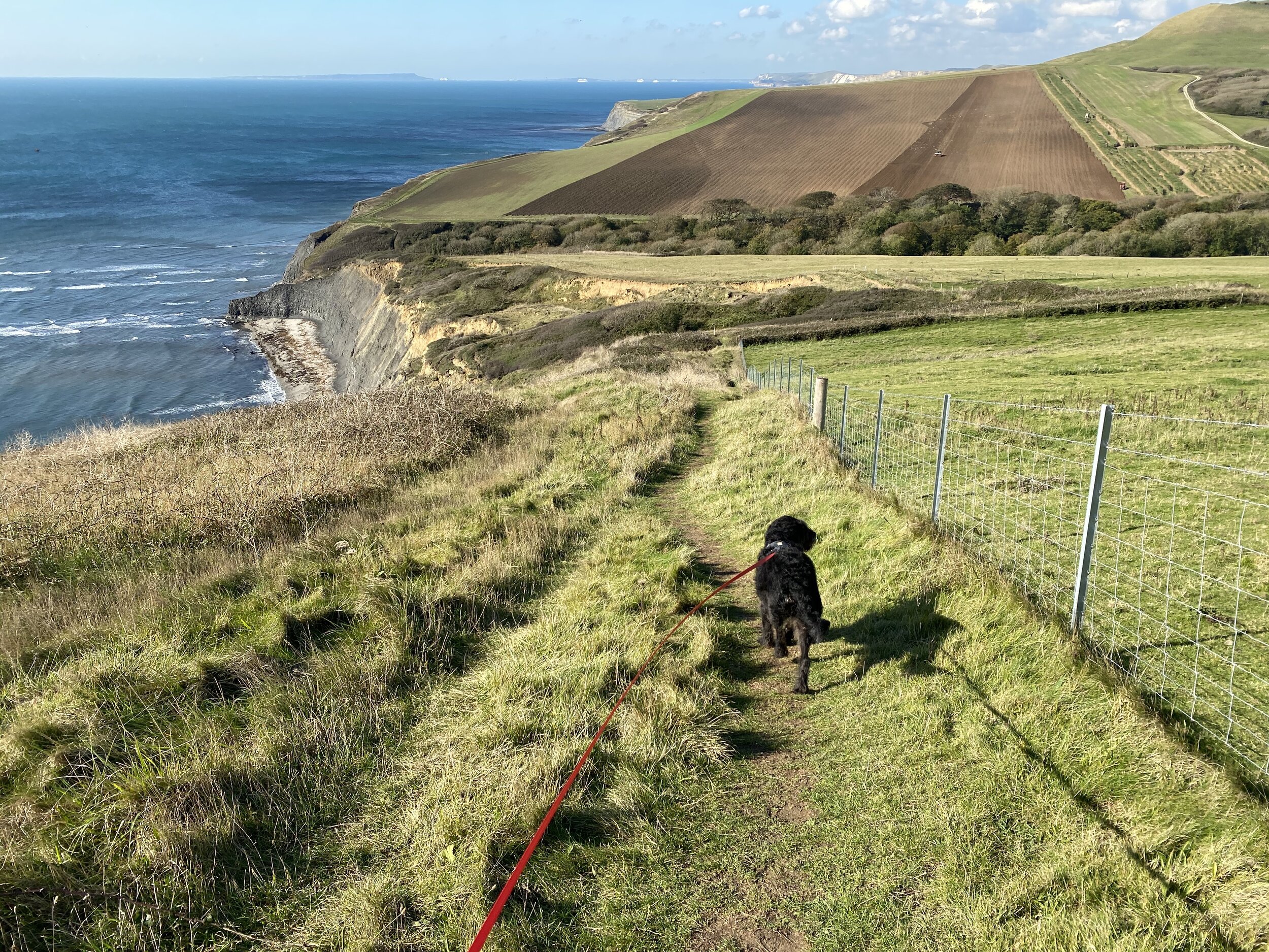
The route up Houns Tout cliff
In an effort to learn from our blind optimism on our first day in Dorset, we considered three different routes for our last section of the South West Coast Path on this trip. One was across Swanage, one out from Worth Matravers to Swanage and finally the route between Kimmeridge Bay and Chapman’s Pool (Worth Matravers).
We chose the final option for a couple of reasons. The first was that it’s the furthest from home (marginally) so we were less likely to do a day trip to complete it – something that would be possible with the Swanage route. The second was that it joined up two other routes we had already completed, so we would have a whole continuous section completed (very exciting!).
We made a tactical decision to walk it backwards* from Chapman’s Pool to Kimmeridge Bay, simply because we had seen the route up the Houns Tout cliff on the other side of the Pool when we did our Worth Matravers loop. It looked steep and high, and quite frankly unpleasant to ascend. It was also clearly the highest point on the whole section. Eat the Frog, as they say. We wanted to tick it off early. As it turned out, this is the best decision we could have made.
We used two cars again – we parked one at Kimmeridge Bay (£5 toll) and then one at our start point in Renscombe Car Park, Worth Matravers (free). Heading out of the same gate onto the coast path as we did for the Worth Matravers loop, we went down the Path straight in front of us and zig zagged to a car track at the bottom, then turned right to walk inland. This route skirts around an inlet, and takes you to a small hamlet of houses where you turn left to head back out to the sea… and towards the cliff climb.
A hairy and windy climb
Once we got to the base of the Hous Tout cliff we realised that actually in terms of height and steepness, it was really a walk in the park compared to what we had already completed in the same week. Even the day before, we had ascended up far more and far steeper steps to the point of St Alban’s Head. However, there was a problem. The wind on this day was predicted to be about 22 miles per hour and it was rushing through the inlet gap.
We waited for two people to descend and then it was our turn.

The view from the top of the steps across Chapman’s Pool
These steps were incredibly exposed. At the base, the first few steps were right on the cliff edge (no fencing!), as you got higher there was slightly more ground around them but not much. On a calm day, it probably would have been fine but being buffeted by the wind as we ascended was not a nice experience. It was a constant push towards the cliff edge and the substantial drop. To give you an idea of the strength of the wind, Rory was being pushed sideways (he’s around 35kg). My mum was using her hands on the steps above to stabilise herself. No photos of this sorry – I was too busy trying to stay upright. When we eventually emerged out of the top of the steps, mum was officially freaked out and shaky (similar to me when I slipped at Winspit the day before).
We passed three couples at the top of the cliff, heading towards the steps. We exchanged pleasantries with them, explained that we were a bit on edge (pun intended) and we found a stone set back from the cliff on the next corner to sit on and give ourselves a bit of time to settle our nerves. As we mused on the likelihood of them descending the steps, they came back, lamenting the dangerous nature of this part of the route and taking an alternative path leading in land. On reflection, if we had decided to walk the route the opposite way, we probably would have been making the same decision as them and diverting. At least going up we couldn’t see how close the drop was, even if we could feel the empty space – there is no hiding from the imminent danger when you are looking straight down at it! We quietly congratulated ourselves on our route decision, had a few more sips of water and headed onward.
A beautiful mostly-flat walk
Steadier descent off Houns Tout cliff heading towards Kimmeridge Bay

Erosion has caused some path diversions
The rest of the route was straightforward, pretty flat and had some minor not-even-hills.
This section of the coastline is clearly suffering quite badly from erosion with a clear crack through the main track we were walking on.
At one point, part of the Coast Path has been recently roped off and the route moved into a field. But although it hugs the disappearing coast (so many blue ocean views on our left), much of the route had a decent amount of space between you and the cliff edge (but very little fencing!). It was a comfortable walk even on a windy day.
The Clavell Tower
Our marker for the end of the walk was a tower on the hill at Kimmeridge Bay. I have terrible long-distance vision and at one point mistook a very ugly brick box (I imagine a war lookout) for the tower. My mum was quick to correct me and it was pretty hilarious – they could not be visually any more contrasting. One looks like a basic shed and one, well, looks like a tower. In case you need to know, the brick box comes first, but when you reach it you’ll be able to see the Clavell Tower.
The Grade II listed Clavell Tower was painstakingly moved back from the crumbling cliff edge over a period of years by The Landmark Trust, finishing in 2008. It’s available for holiday lets, although it has previously been called ‘Britain’s Most Booked Up Room’ and I can see why. What a quirky building and an amazing location! It’s worth noting that you do have to climb quite a few steps to get to it – maybe not a great choice for people who like to pack their whole lives to go on holiday, unless they are happy to leave it all in the car.
We descended the (steep) steps with a hovering kestrel over the fields on our right. At the bottom of the steps there is the Wild Seas Centre – we didn’t visit this time, but they hire out snorkelling equipment (probably in non-COVID times) and they promote rock pooling when the tides allow!

Clavell Tower
A couple of minutes later and we are passing the toilet block and heading back into Kimmeridge Bay Car Park which, by the way, looks like a great place to park and look at the view. There were a few older couples with their fold out chairs and cups of tea set up, just gazing out to sea.
However, still no ice cream truck for us this time. I’m still waiting for my first SWCP Ice Cream experience!
*technically we are walking the whole route ‘backwards’, so this might actually be the correct way. Is there a correct way to walk a National Trail? I’ll leave you with that thought.
Walk Statistics


If you liked this post, you can subscribe to my newsletter to receive my writing on travel, nature, sustainability and outdoor activities straight into your inbox. If you have found my content useful and want to support my writing, you can buy me a coffee here.